Intelligence from above: how Earth observation and AI are transforming climate and biodiversity action
A new era of Earth observation (EO) – satellite-based monitoring of the planet – is transforming how we measure and manage environmental risk. But as the view from space grows sharper, so too does the imperative to turn intelligence into action
Climate
Author
Jumpei Takami
Associate Expert in Remote Sensing for Disaster Management, UN-SPIDER Program, United Nations Office for Outer Space Affairs (UNOOSA)
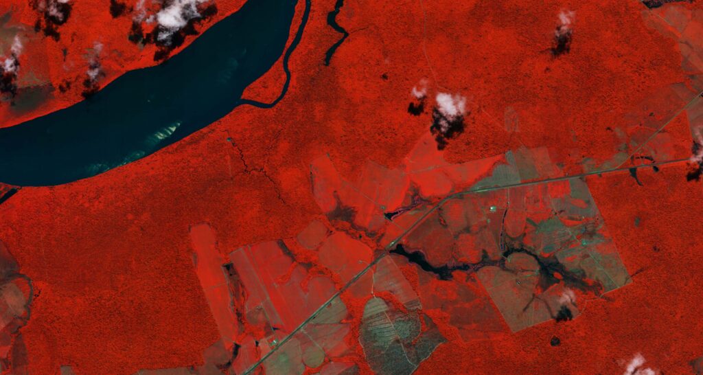
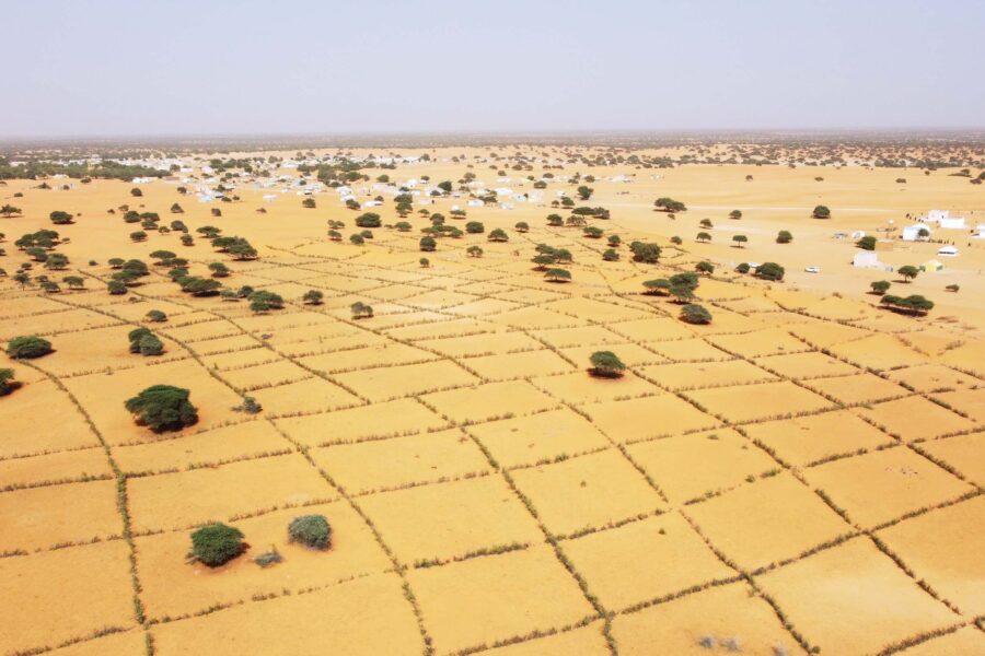
Climate change and biodiversity loss are often described as twin crises: intertwined, accelerating, and increasingly visible from space. From shrinking glaciers to bleaching coral reefs and vanishing forests, satellite data now provides an unprecedented view of the Earth’s changing systems. However, the challenge is not only to observe, but to understand, predict, and respond. Advances in Earth observation (EO) technologies, coupled with artificial intelligence (AI), digital twins, and edge computing (see explanations below), are rapidly reshaping how nations, governments, and businesses translate “intelligence from above” into meaningful climate and biodiversity action.
Yet as the data revolution accelerates, decision-making has lagged. While EO has moved from data collection to decision intelligence, many governments and institutions have yet to catch up. The gap between what we can see and what we act upon remains wide.
The Sustainable Development Goals (SDGs) set an ambitious blueprint for the planet. Among them, SDG 13 (climate action), SDG 14 (life below water), and SDG 15 (life on land) stand out as the backbone of global environmental sustainability. SDG 17 (partnerships for the goals) underscores that only cooperation makes progress possible. Satellite technology serves as the common thread connecting these goals: offering the means to measure, monitor, and model change at both global and local scales.
But data alone will not save the planet – integration into governance, finance, and accountability is where the real impact begins.
EO for climate action (SDG 13)
As climate-related hazards intensify, the need for anticipatory action grows. EO supports SDG Target 13.1, strengthening resilience through flood, drought, and wildfire monitoring. Projects such as the United Nations Platform for Space-based Information for Disaster Management and Emergency Response’s (UN-SPIDER’s) SEWS-D in Central America have demonstrated how vegetation indices derived from EO can enable early warning systems for droughts, integrating seamlessly into national policies and risk management frameworks.
Beyond early warning, EO supports the implementation of national climate strategies (Target 13.2) by tracking the extent to which mitigation and adaptation commitments materialize on the ground. The European Space Agency’s Sentinel-5P satellite, launched in 2017, and its forthcoming CO₂M (carbon dioxide monitoring mission in 2025 and 2026) quantify greenhouse gas concentrations, providing an independent, transparent basis for emissions tracking. This form of space-based accountability ensures that policy promises are matched with observable progress – a rare commodity in climate politics.
EO for ocean health (SDG 14)
The ocean, our planet’s largest carbon sink, is under increasing strain from warming, acidification, and pollution. EO plays a central role in Target 14.1 by mapping eutrophication (the accumulation of nutrients in water, fueling organisms that may deplete oxygen levels) and tracking floating plastic debris through high-resolution imagery and spectral analysis, such as using data from NASA’s MODIS and ESA’s Sentinel-3 sensors. The integration of ocean color remote sensing (OCRS) with automatic identification system (AIS) data (which tracks ships worldwide) enables near-real-time detection of illegal, unreported, and unregulated (IUU) fishing – a major threat to marine biodiversity.
Equally, EO facilitates the management of marine protected areas (MPAs) under Target 14.5, providing systematic spatial coverage and temporal consistency. By combining multispectral and radar satellite datasets, scientists can monitor benthic habitats (ecological regions at the lowest level of a body of water), coral bleaching, and mangrove deforestation, ensuring that conservation zones are not only declared but maintained.
EO for life on land (SDG 15)
Terrestrial ecosystems are the foundation of human wellbeing, but they are rapidly deteriorating. EO technologies are essential for tracking deforestation, desertification, and biodiversity loss, aligning with Targets 15.1 to 15.3. Platforms such as Global Forest Watch (founded by the World Resources Institute) and the United Nations Convention to Combat Desertification’s (UNCCD’s) Trends.Earth platform enable open-source tracking of forest loss and land degradation.
Moreover, machine learning (computer algorithms that learn patterns from large datasets) applied to high-resolution imagery supports Target 15.5, helping to detect habitat fragmentation and monitor wildlife corridors. The combination of EO data with GPS-tagged wildlife tracking has already improved anti-poaching surveillance, as demonstrated by Airbus’ high-resolution satellite imagery used to investigate rhino poaching in South Africa. These efforts collectively bring transparency and precision to global biodiversity conservation.
But the leap from monitoring to management remains incomplete. Unless EO insights are embedded in national land-use planning and financing frameworks, the view from space will remain an afterthought rather than a driver of conservation.
Partnerships and capacity building (SDG 17)
None of these advancements can succeed in isolation. The EO ecosystem thrives on partnerships – between agencies, governments, academia, and private companies. SDG 17 underscores this need, highlighting that global progress depends on shared data, open platforms, and equitable capacity development.
Through initiatives such as UNOOSA’s UN-SPIDER program, the Group on Earth Observations (GEO), and the Committee on Earth Observation Satellites (CEOS), space data has become increasingly accessible to developing nations. This democratization of satellite information empowers nations to build their own models, manage risks, and strengthen policy coherence across SDGs – turning access into agency.
To close the gap between capacity and capability, these partnerships must now focus on integration by linking EO data with national statistical systems, budgets, and regulatory tools.
The next frontier: digital twins, GeoAI, and edge intelligence
While traditional EO systems capture “what is happening,” emerging technologies reveal “why” and “what if.”
Digital twins
Virtual replicas of Earth’s systems, digital twins merge satellite imagery, ground data, and physics-based models to simulate complex environmental interactions. For instance, UN-SPIDER’s pilot digital twin simulates sea-level rise scenarios to support adaptive planning for coastal resilience.
GeoAI
Geospatial artificial intelligence (GeoAI) – the application of AI to map-based data – extends this by automating pattern recognition, damage assessment, and land-cover classification, transforming petabytes of satellite data into actionable insights within minutes (as illustrated in UN-SPIDER’s work on mapping disaster resilience).
Edge computing
Edge computing (processing data closer to where it’s collected), meanwhile, brings processing closer to the satellite itself. Instead of downlinking massive datasets, satellites equipped with on-board AI now analyze data in orbit, delivering only the most relevant outputs – a breakthrough for time-critical applications like disaster response.
Embeddings
Embeddings are compact numerical representations that capture patterns of place, seasonality, texture, and change across sensors and time. Built from multi-sensor EO and aligned with climate and in-situ observations, they enable search and classification by meaning rather than raw pixels, improving analytical quality and allowing few-shot (from just a few examples) and zero-shot (from none at all) detection of novel change while supporting consistent indicators across countries and years.
Geospatial foundation models
Pre-trained on large EO and biodiversity archives, geospatial foundation models learn transferable features for climate and nature tasks, from forest degradation and drought stress to coral bleaching risk. With light fine-tuning, they generate local products with quantified uncertainty and harmonize inputs from different satellites and revisit intervals. Paired with systems that automatically link their outputs to trusted data sources, they turn imagery into defensible evidence in minutes.
GenAI
Finally, generative AI (GenAI) is beginning to bridge the gap between observation and communication. It can transform raw EO data into human-readable narratives, synthesize plausible environmental futures, and assist policymakers in visualizing trade-offs and risks in near real-time.
Together, these technologies represent a paradigm shift – from passive observation to active planetary intelligence.
When integrated with strong partnerships and ethical governance, they can accelerate our collective ability to combat climate change and preserve biodiversity. The task ahead is ensuring that this intelligence flows into real-world policy, finance, and local action faster than the crises evolve.
Conclusion
The Earth is now observed more completely than ever before, yet our window to act remains narrow. The true value of “intelligence from above” lies not in the satellites themselves but in how humanity uses their insights – to anticipate disasters, to regenerate ecosystems, and to ensure that the planet’s natural systems can sustain future generations.
EO has given us the evidence. What remains is the execution. From orbit, the message is clear: the planet is changing fast. The question is whether we can change faster.
Featured in:
Climate Action edition 2025
Beyond the disappointing headlines from COP30, progress is still being made on climate action. Even without the roadmap for the phaseout of fossil fuels making it into the conference's final statement, fossil fuels are on their way out. Renewables have already reached the tipping point where they are commercially more attractive than fossil-fuel alternatives - momentum for the transition will start to gather pace.
This edition picks up on themes from the latest COP: systems transformation, human dimensions and planetary stewardship.
Authors include: Yamide Dagnet, Emi Minghui, Selen Inal, Jumpei Takami, Bilel Jamoussi, Karen Ellis, Mohamad Ansarin, Diana Denke, Juan Lucas Restrepo, Beatrice Mosello, Alexandra Steinkraus, Mauricio Voivodic, Meghna Das, Mariana Matoso, Bernardo Arce and Mia Calle.
Publication date: 26 November 2025


Related articles
Delivering urban water under uncertainty
Safe, affordable water in urban areas is central to sustainable development, yet progress remains uneven. To close this gap, cities need to adopt integrated, evidence-based approaches that build resilient and equitable services in practice

Redefining sustainable water management for a water-scarce world
Through innovation, foresight, and rigorous alignment with global standards, Dubai Electricity and Water Authority (DEWA) is pioneering a future-ready water management model that safeguards reliability, sustainability, and resilience, contributing meaningfully to the achievement of SDG 6
Science-based policymaking – bridging the gulf between promise and reality
We have built an intricate understanding of the dynamics between climate change, environmental systems, and resource use. We have also made huge strides in developing tools to analyze and model data. Why, then, are we not using this science to direct policy?